



Vegetation management plans: Assington and Leavenheath
Between mid-September and the end of October 2026, we're carrying out vegetation management works at various locations along the route of the project. This post summarises the works planned in and around Assington and Leavenheath.
What's happening?
Between the middle of September and the end of October, we're carrying out vegetation trimming, pruning, coppicing and removal works at various locations.
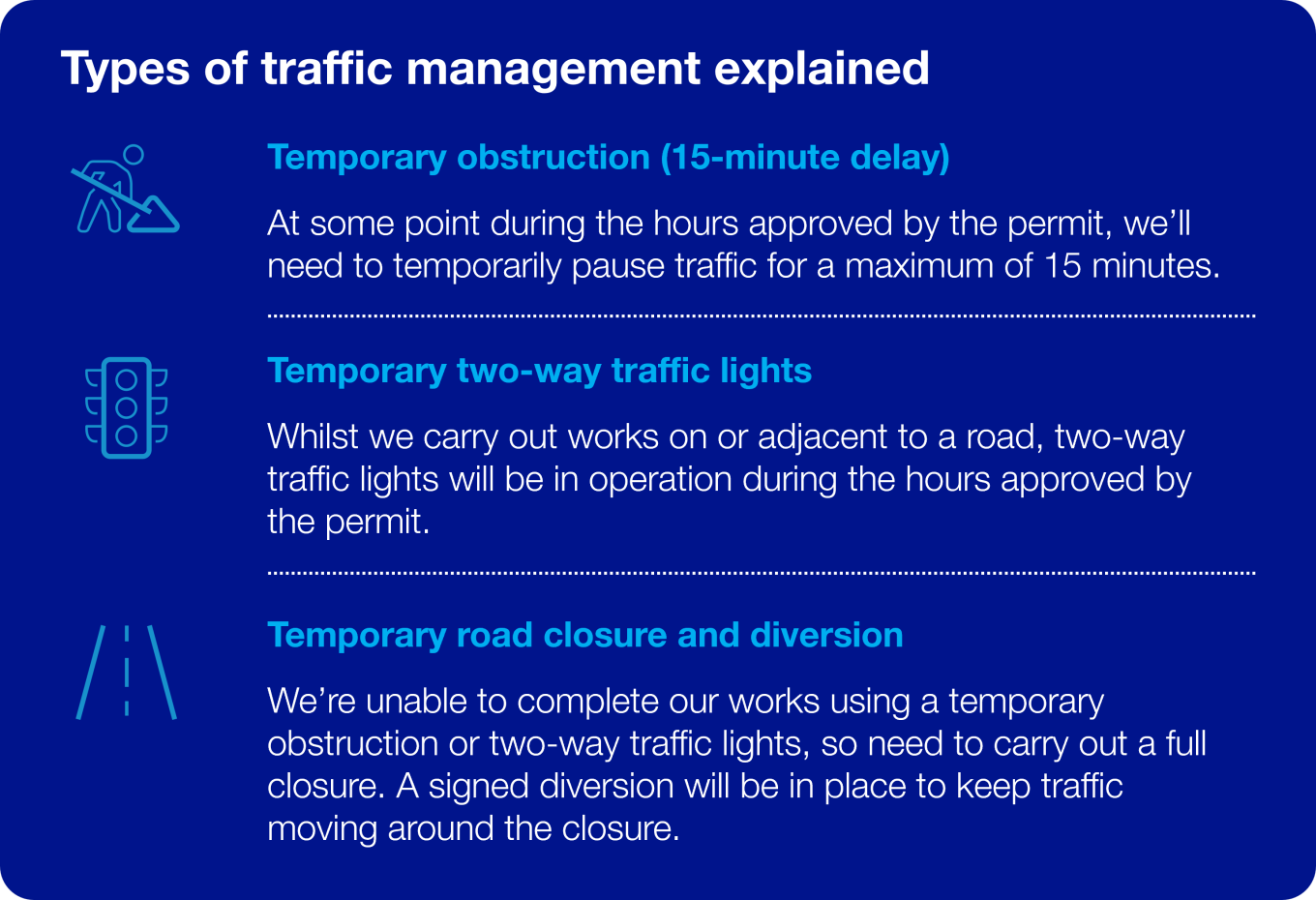
Some of the vegetation works will take place alongside public roads. We’ve therefore applied for a series of traffic management permits from Suffolk County Council, who are the local highways authority. This is so we can keep everyone safe whilst the works are carried out. Some of the permits for these works have already been approved, whilst others are still being reviewed by the Council.
To help people plan their journeys, this update includes an overview of all the works currently planned in and around Assington and Leavenheath. These dates are subject to change, particularly where we’re still waiting for a permit to be approved.
Why are you doing this?
We need to carry out vegetation management works for several reasons. For example, where the new overhead line passes over existing vegetation, we need to maintain a safe distance between the top of the vegetation and the overhead line. In areas where we are building a temporary new haul road, we need to manage or remove vegetation where it could cause visibility issues for construction vehicles entering or exiting the haul road.
We’re carrying out these works now as this is one of two times in the year that Natural England has granted us a dormouse mitigation licence. It’s also outside of nesting bird season. You can find out more about why we need to carry out vegetation management on our website here.
Planned works
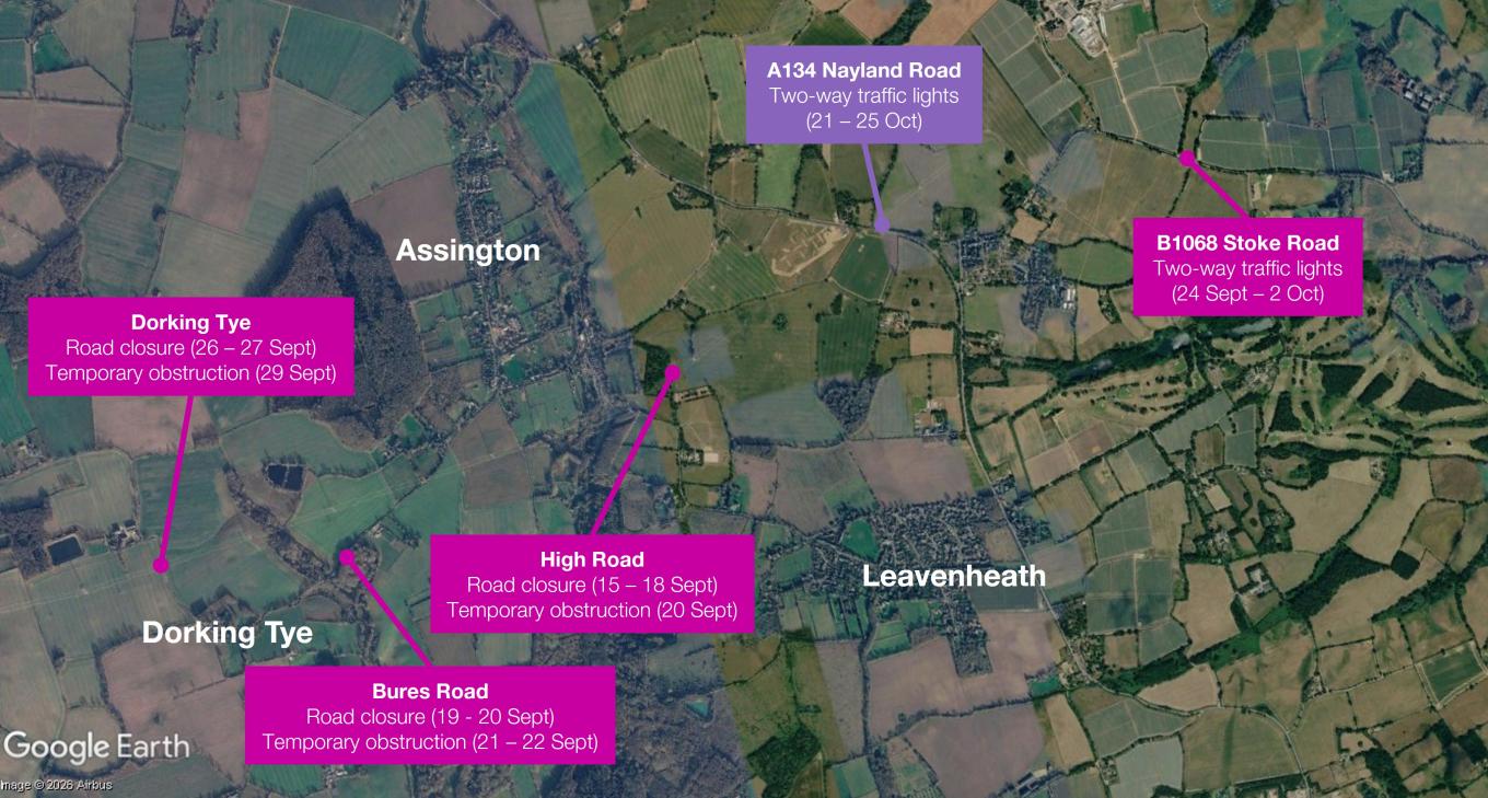
The map and table below shows the traffic management works associated with vegetation management between now and the end of October. This map and table is correct at the time of publication.
For the latest updates, please see the 'What's happening now?' page of our website. You can also sign-up for updates via WhatsApp here.
| Road name | Type of traffic management | What3words | Dates | Timings | Note |
| High Road, Honey Tye | Road closure with diversion | markets.fend.tabs to defenders.tentacles.verve | 15 - 18 September | 8am – 5pm | Permit approved |
| Bures Road, Dorking Tye | Road closure with diversion | thickens.identity.boater to single.throw.intervene | 19 - 20 September | 9:30am - 2:30pm | Permit approved |
| High Road, Honey Tye | Temporary obstruction (15-min delay) | markets.fend.tabs to defenders.tentacles.verve | 20 September only | 8am - 5pm | Permit approved |
| Bures Road, Dorking Tye | Temporary obstruction (15-min delay) | thickens.identity.boater to single.throw.intervene | 21 - 22 September | 8am - 5pm | Permit approved |
| B1068 Stoke Road | Two-way traffic lights | haunts.vision.passwords | 24 September - 2 October | 8am - 5pm | Permit approved |
| Dorking Tye | Road closure with diversion | sparkles.amicably.wheat to supposes.hypocrite.logbook | 26 - 27 September | 9:30am - 2:30pm | Permit approved |
| Dorking Tye | Temporary obstruction (15-min delay) | rifled.potential.label to variously.kitten.disengage | 29 September only | 8am - 5pm | Permit approved |
| A134 Nayland Road | Two-way traffic lights | pampering.fines.standards | 21 - 25 October | 9:30am - 3pm | Permit approved |