Our marine proposals
This page sets out our proposals as presented at our statutory consultation between 24 October and 18 December 2023. Although the consultation has now closed, this page has been left online for reference use.
Our marine proposals include:
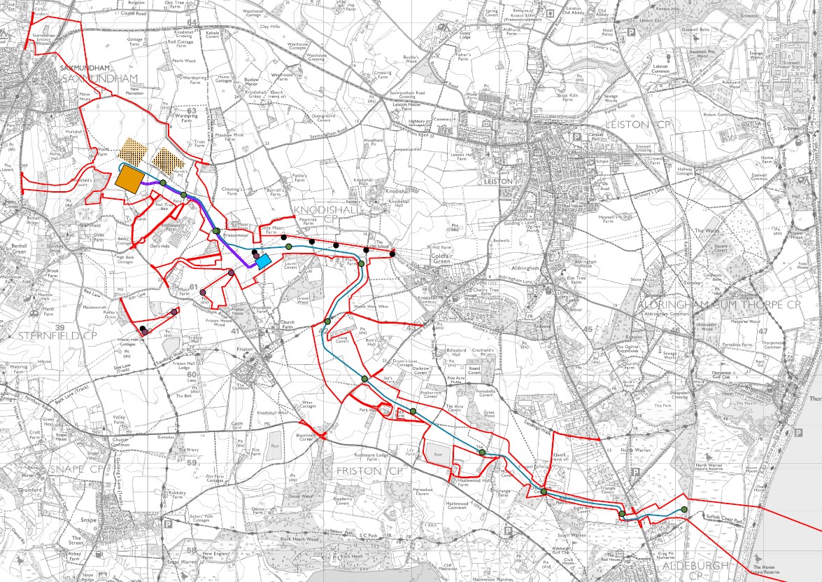
- approximately 130 km of subsea high voltage direct current cable (HVDC), running between the Suffolk landfall location (between Aldeburgh and Thorpeness), and the Kent landfall location at Pegwell Bay.National Grid Electricity Transmission has considered and assessed a number of options for the marine route corridor. These options have been narrowed down to a single marine route corridor, approximately 130 km of subsea HVDC cable, running between the Suffolk landfall location (between Aldeburgh and Thorpeness), and the Kent landfall location at Pegwell Bay.
The marine HVDC cables would be routed south from the Suffolk landfall through a section of the Outer Thames Estuary Special Protection Area and to the west of the existing Greater Gabbard and Galloper offshore wind farms. They would head east through the Sunk Traffic Separation Scheme, turning south to route around Margate and Long Sands Special Areas of Conservation and between a number of mineral aggregate sites. The marine HVDC cables would then continue south to the east of the London Array offshore wind farm and west of the Thanet offshore wind farm before turning west to make landfall in Pegwell Bay.
The subsea cable and associated infrastructure would be installed along our proposed marine corridor, with the exact alignment of the cables informed by further marine surveys and statutory consultation feedback. Our corridors have been developed through consultation with marine stakeholders and technical and ecological surveys.
Other factors that have influenced the marine corridor include:
- reducing interactions with ecologically sensitive areas, anchorages and areas of archaeological importance
- avoiding offshore infrastructure
- minimising crossings of other cables and pipelines
- minimising interaction with other marine users, such as shipping and navigation and fishing activities.